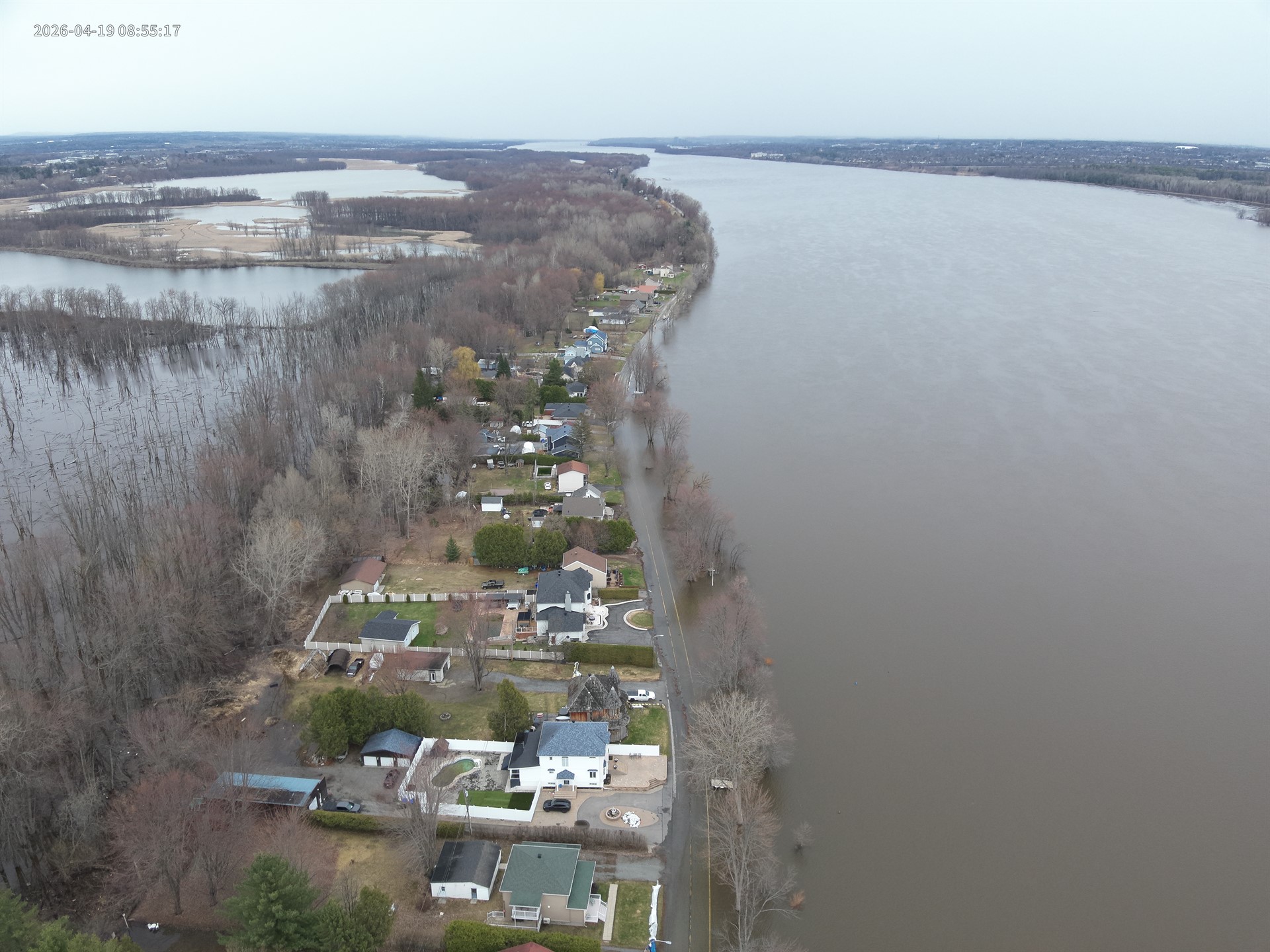
Flood update – Higher levels forecast: water levels continue to rise
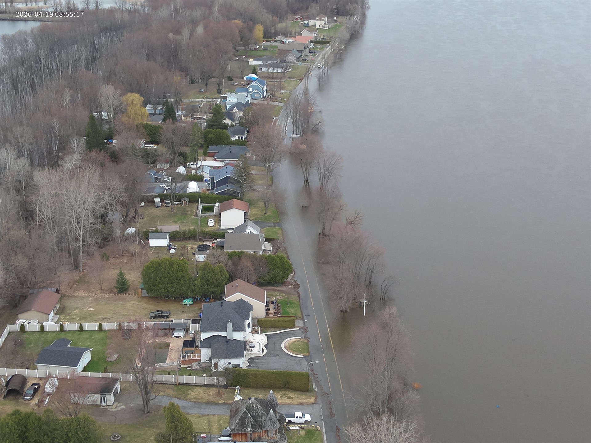
Gatineau, April 19, 2026. – The latest forecasts shared by the Ottawa River Regulation Planning Board (ORRPB) on Friday were revised upwards late yesterday. Ottawa and Gatineau river water levels continue to rise. Forecasts are overall higher than those for 2025, but lower than those for 2023. Water levels may start stabilizing on Tuesday, but are expected to remain high for several days. Current forecasts indicate that approximately 41 roads will be affected by water and 164 buildings are at risk of flooding.
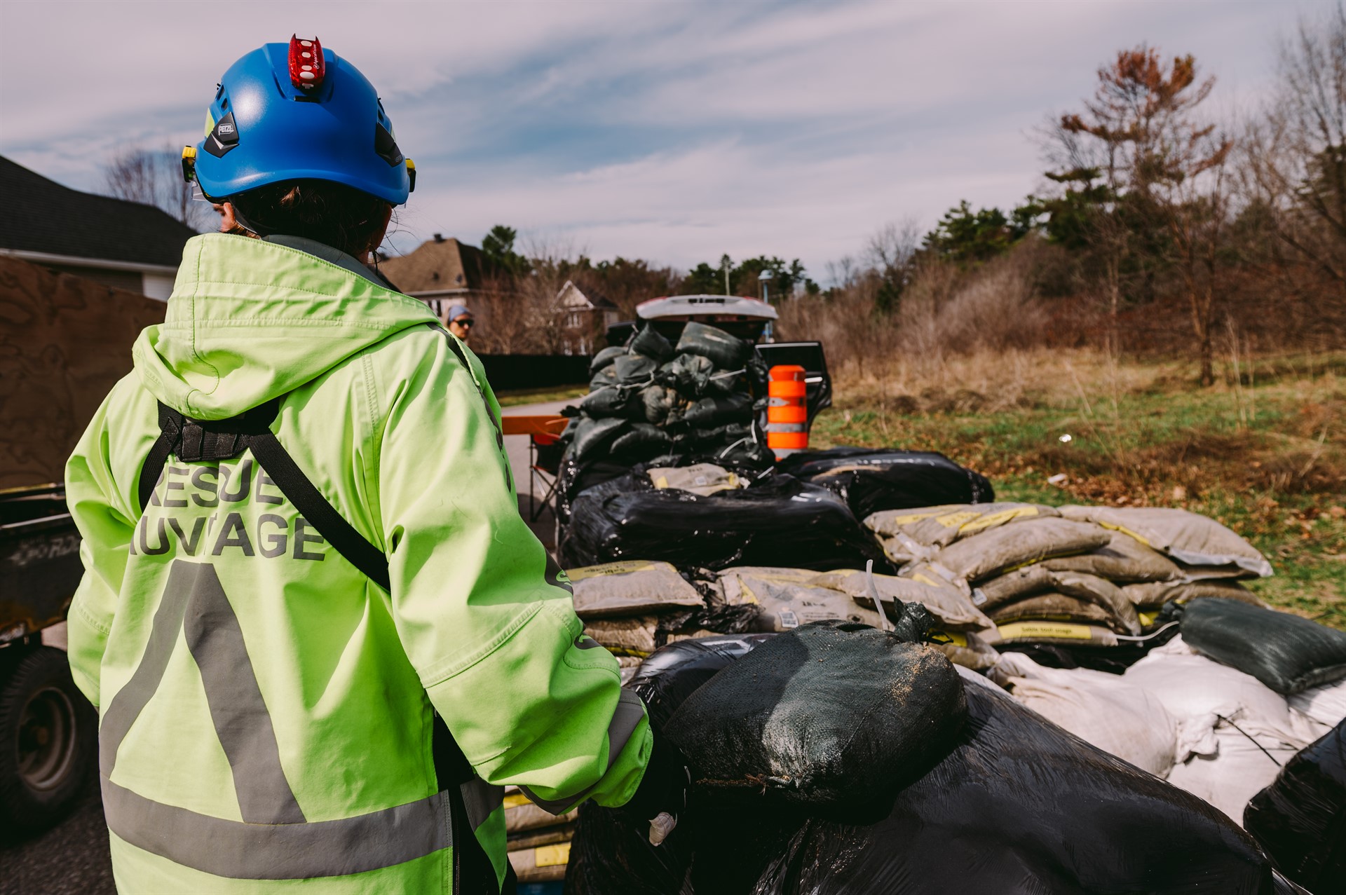
Municipal crews remain fully mobilized and are monitoring the territory. In addition, Service de sécurité incendie representatives are continuing to go door-to-door to reach residents in the flood-prone areas.
Impact on traffic
| ● | New roads are under observation in the Gatineau sector:
– access ramps for autoroute 50 Est at rue Saint-Louis;
– rue Campeau;
– rue Carmen;
– rue Saint-Denis;
– rue Saint-Paul;
– rue Saint-Sauveur;
– rue Sanscartier; and
– ruelle du Como. |
| ● | Vehicle movements are affected by water in the affected sectors. A map with real-time updates can be viewed at gatineau.ca/flood.
– In addition to slowing traffic on certain roads, water has caused road closures (parts or all). As well, some roads are open to local traffic only. |
| ● | People should avoid driving in at-risk areas. If they must be accessed, it is imperative that drivers exercise caution and slow down. Fast-moving vehicles, especially frequent movement, generate waves that can cause damage. |
| ● | Worrisome situations can be reported to the 311 non-emergency call centre. If personal or property security is threatened, call 911. |
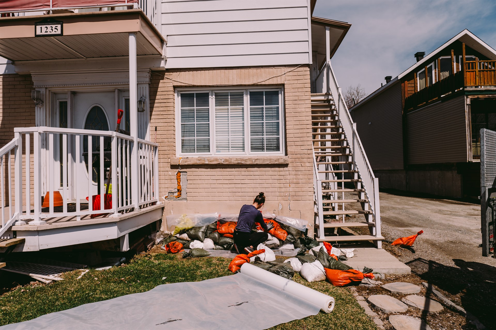
Distribution of sandbags
| ● | Sandbags are available at different sites across the territory. For their locations, go to gatineau.ca/flood.
– Please note that residents are responsible for loading the bags into their vehicles.
– Residents are asked to collect sandbags gradually to ensure that everyone gets some and can start building their dykes. |
| ● | These sites were selected based on specific criteria, essentially safety, accessibility and traffic flow to reduce wait times. |
| ● | New! At the parc du Lac-Beauchamp site, flatbed trucks are now permitted. However, mechanized loading remains the responsibility of users. Thus, it is important to notify 311 ahead of time, along with the list of addresses that will be supplied.
– Important! Please note that Gatineau reserves the right to reassess the situation based on inventories to ensure equitable availability for all shoreline property owners.
– Other non-standard vehicles (e.g. front-end loaders, dump trucks, etc.) are not permitted. |
| ● | Heavy machinery and non-standard vehicles are not permitted at any of the other sites. Residents are asked to use light vehicles such as cars, vans or small trailers.
– These rules aim to ensure the safety of the people at the sites in crowded areas with limited space while maintaining an efficient pace for loading. |
| ● | Sauvetage Bénévoles Outaouais volunteers will be on hand to support operations and guide people around the site. |
| ● | A small number of sandbags may be damaged due to normal wear and tear and handling. If that happens, residents should report it immediately so the bags can be quickly replaced. |
Quote
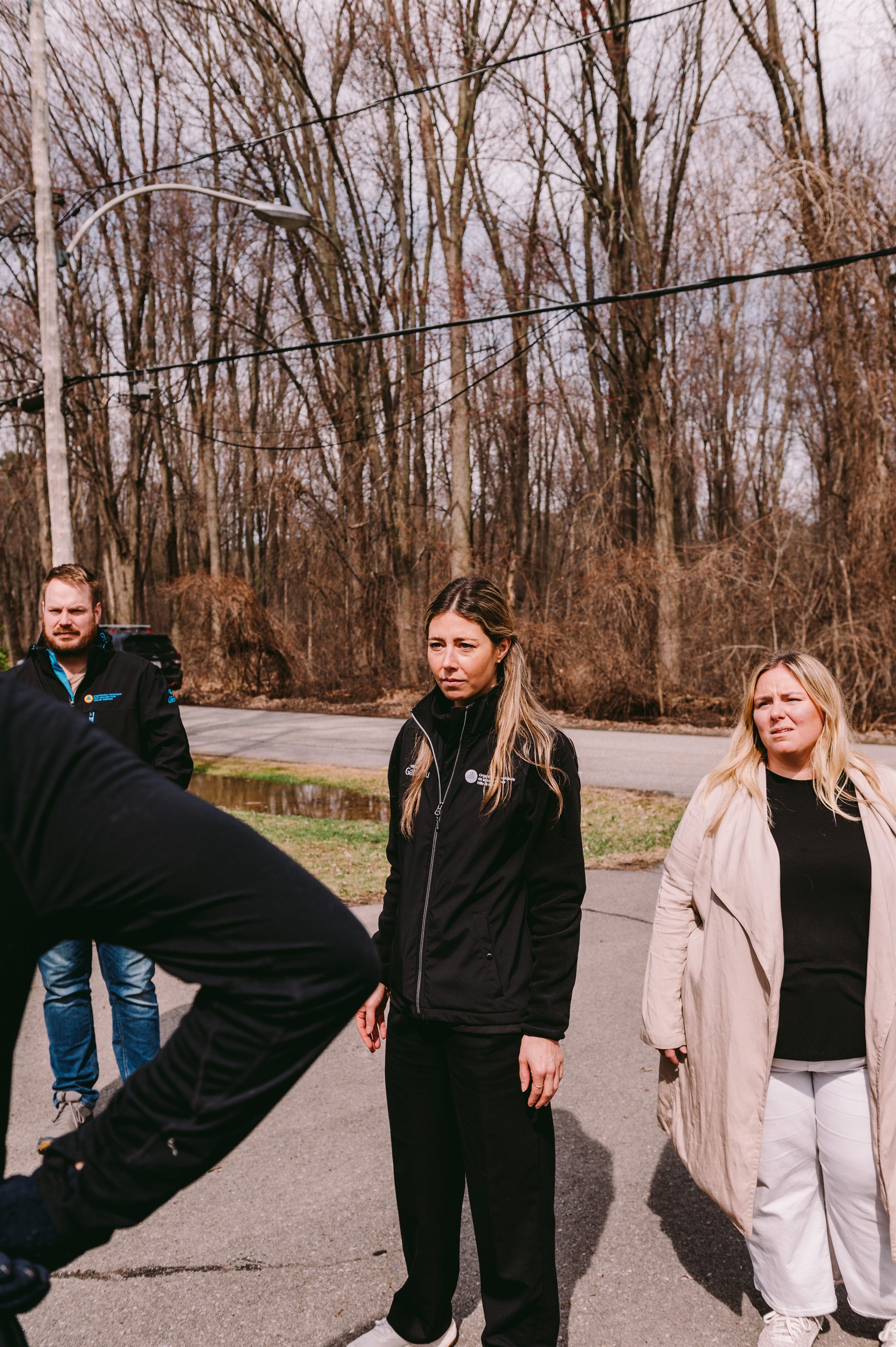
“Our crews are fully mobilized, and are proactively intervening to anticipate changes in the situation and protect the affected sectors. We know all of this can be overwhelming, which is why we are committed to keeping the lines of communication open so everyone can follow the situation and make the right decisions when the time comes. We are also relying on everyone's cooperation and sense of civic duty. By treating the crews on the ground and other residents with respect and kindness, we will all get through this situation in the best possible way,” indicated Gatineau Mayor Maude Marquis-Bissonnette.
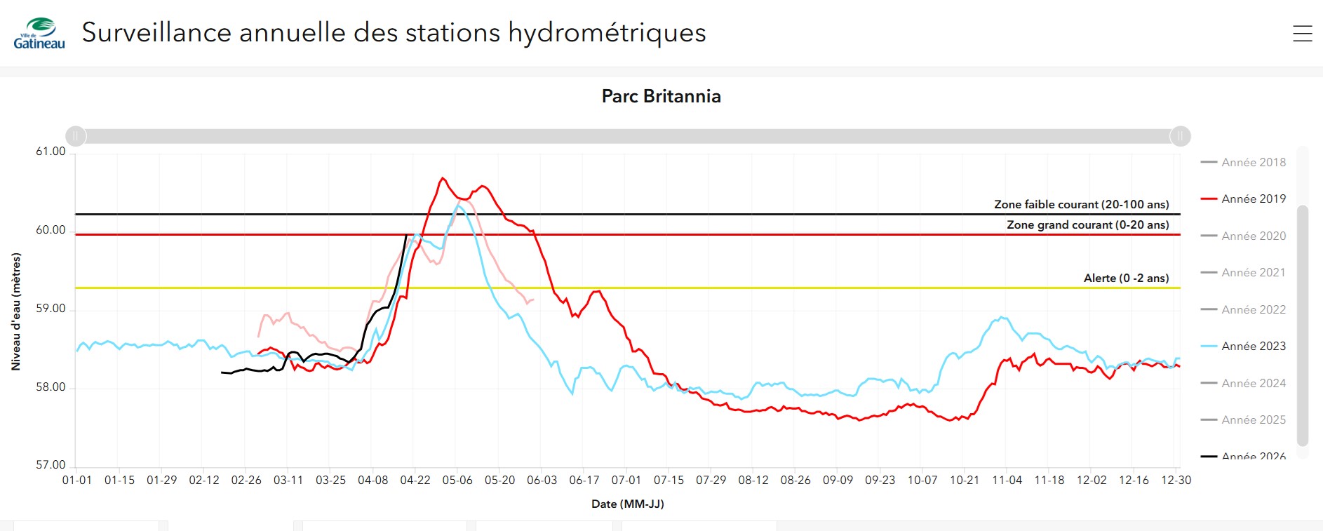
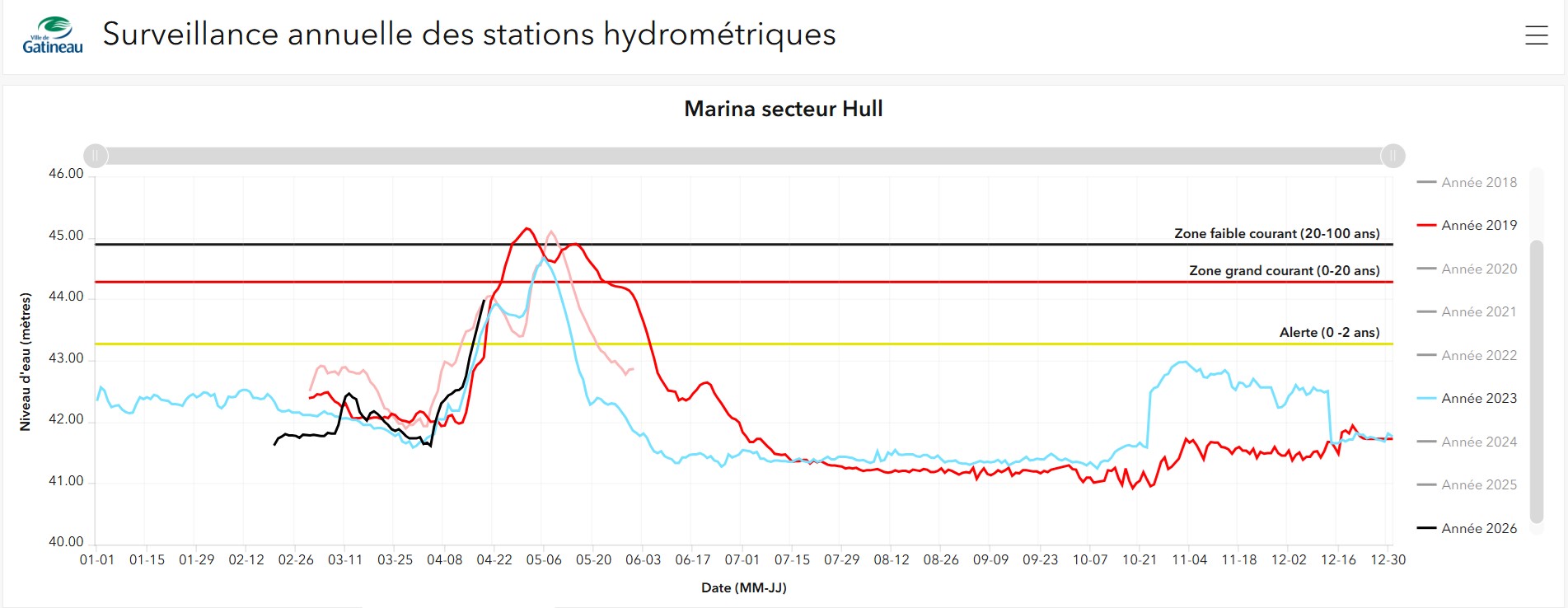
Comparison of water levels
The images below compare the water levels recorded in 2026 (in black) and those in previous years, as of today. Steps have been taken at the Hull and Britannia Park marinas.
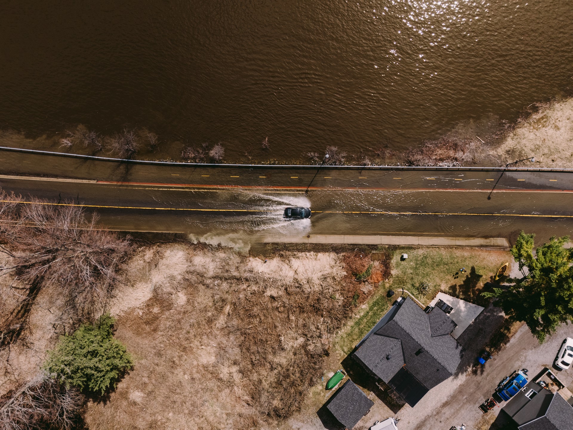
Photos taken Saturday, April 18
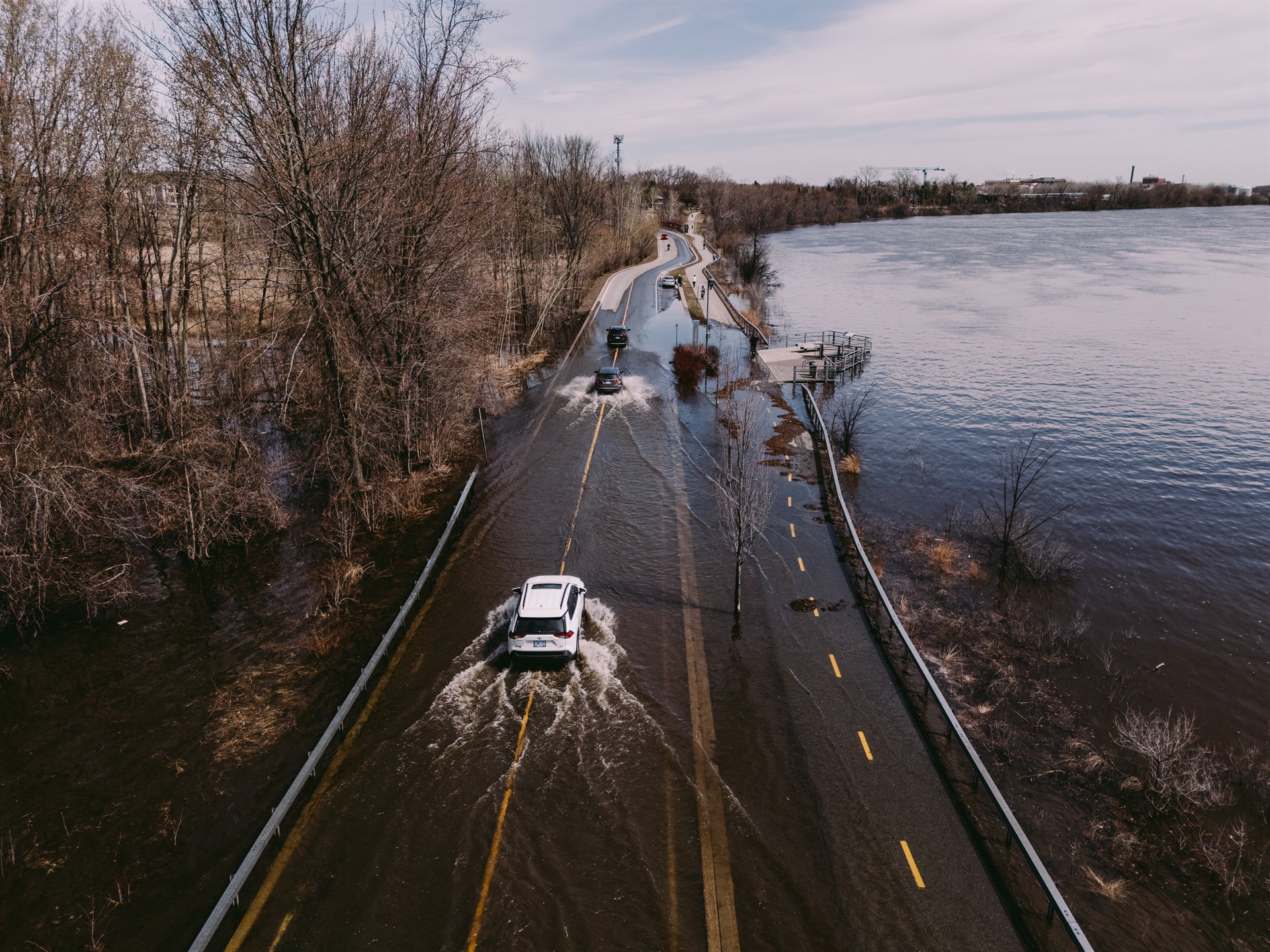
Photos taken Sunday morning, April 19
Associated links
Ottawa River Current Conditions
Spring freshet
Prepare
Stay tuned