|
Flood update – Opening of the flood victims relief centre
Gatineau, April 20, 2026. – Given the way the situation is evolving, Gatineau is introducing measures to assist affected residents, including, as of tomorrow, opening a flood victims relief centre. Municipal crews are at the ready to ensure everybody's safety and to assist affected residents. Flood victims relief centre | ● | A flood victims relief centre will open tomorrow, April 21, from noon to 8 p.m., at the Centre sportif de Gatineau (850 boulevard de la Gappe, Gatineau sector). It will then be open daily during those hours.
– The centre's schedule may be re-assessed and adjusted as needed. The public will be notified of any changes. |
| ● | Anyone needing to avail themselves of the services should report to the sport centre's reception desk. Red Cross representatives will assess their needs and address them, or simply register them as flood victims. Proof of residence will be required.
– The Red Cross may provide emergency housing or any special support related to the flooding.
– People who are registered will have access to several services, including wellness calls and information about the government's flooding or other disaster related financial support program. |
| ● | For emergency and immediate evacuation, call 911. |
April 19 update from the Ottawa River Regulation Planning Board (ORRPB) | ● | The last update shared by the ORRPB late yesterday indicates that:
– Water levels and currents are continuing to rise all along the main section of the Ottawa River.
– Over the next two weeks, water levels should stabilize or slowly fall depending on weather conditions. |
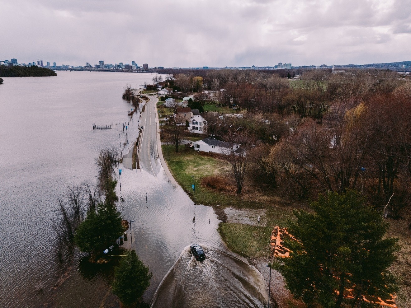
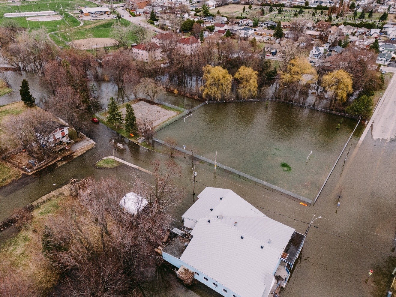
| ● | At this point, it is estimated that 45 roads will be affected by the flooding and that 166 buildings are at risk of being flooded. |
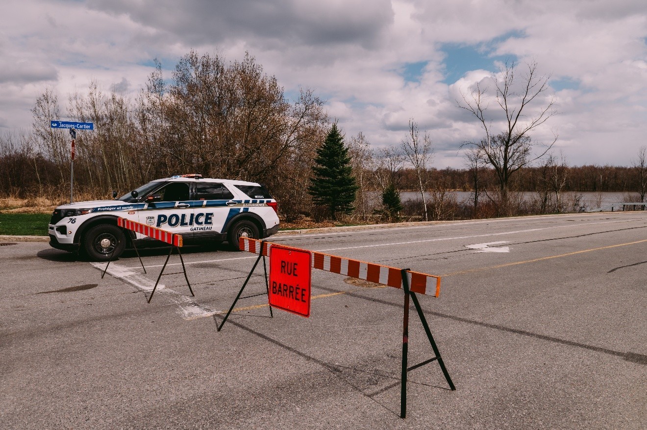
Impact on traffic | ● | Additional road sections are now under observation in the Aylmer sector:
– rue de la Cédričre;
– rue Hemlock; and
– rue Jubilee. |
| ● | The presence of water has impacted traffic in the affected sectors. You will find a real-time map at gatineau.ca/flood. |
| ● | People should avoid driving through the at-risk areas. If this cannot be avoided, it is imperative that they be prudent and drive slowly. Fast-moving, frequent traffic generates waves that can cause damage. |
Monitoring the territory | ● | Municipal crews are at the ready for every kind of intervention and rapid response to ensure the safety of residents. As well, Service de sécurité incendie representatives are going door-to-door in the areas likely to be affected. |
| ● | Municipal crews are at the ready for every kind of intervention and rapid response to ensure the safety of residents. As well, Service de sécurité incendie representatives are going door-to-door in the areas likely to be affected. |
| ● | Gatineau's Service de police and Service de sécurité incendie have vehicles that can drive through flooded streets. They also use water craft, namely boats designed for shallow waters, to access the sectors most affected by rising waters. |
| ● | Important! No drone or aircraft is authorized in the flooded areas up to 600 feet from the flooded ground to avoid interfering with emergency operations. The airspace is currently under the control of the Service de police, in accordance with section 5.1 of the Aeronautics Act.
– Pilots are required to check NOTAMs before flying.
– Failure to comply with this requirement may have significant consequences, including fines. |
| ● | Worrisome situations can be reported to the 311 non-emergency call centre. If personal or property security is threatened, call 911. |
Parking | ● | The following parking lots are open to shoreline property owners unable to park on their driveway or street:
– Église Sainte-Trinité parking lot at 664 rue Duberger (Gatineau sector). People are asked to park their vehicles at the easternmost part of the parking lot; and
– Amicale Pierre Lafontaine parking lot at 74 rue Moreau (Gatineau sector). |
Garbage collection | ● | Garbage collection on roads affected by flooding is temporarily suspended in the interest of public safety and to protect shoreline infrastructures.
– Truck traffic would accentuate water movement and weaken the dykes. |
| ● | As soon as a road is designated for monitoring, the public's collaboration is essential: bins must be kept off the roads.
– Gatineau would like to avoid having bins tip over in the water or having garbage spread by the current, which would raise issues of contamination. |
| ● | Clearly identified containers have been installed in safe locations. Residents on flooded roads should place their garbage in them, making sure they are properly sorted. |
| ● | The interactive map showing the location of the containers is continuously updated in accordance with the changing situation. It can be consulted at gatineau.ca/flood. |
Reminders – Distribution of sandbags | ● | Sandbags are available at different locations throughout the territory. Those locations can be viewed at gatineau.ca/flood.
– Residents are responsible for loading the sandbags and are asked to collect them gradually. |
| ● | At the parc du Lac-Beauchamp site, flatbed trucks are permitted, but mechanized loading is the responsibility of users. Also, 311 must be notified ahead of time, along with the list of addresses that will be supplied. |
| ● | Anyone wishing to lend a hand filling bags is asked to report directly to parc du Lac-Beauchamp. |
Quote
“The situation is changing, and municipal crews are at the ready to help affected residents. Concrete and human support will be provided at the relief centre with the help of the Red Cross to anyone needing it. I encourage anyone who is concerned not to hesitate to avail themselves of the services offered,” indicated Gatineau Mayor Maude Marquis-Bissonnette.
Images
Associated links
Ottawa River Current Conditions Spring freshet Prepare Stay tuned
|